How to Hike the Strada Delle 52 Gallerie in Northern Italy
Tucked into the rugged cliffs of Monte Pasubio in Northern Italy lies one of the most unforgettable hikes in Europe—the Strada delle 52 Gallerie.
Originally built by Italian soldiers during World War I to safely move troops and supplies, this awe-inspiring trail winds through 52 hand-carved tunnels that snake their way up the mountain.
Today, it’s a bucket-list experience for hikers drawn to dramatic landscapes and powerful history. In this guide, I’ll walk you through everything you need to know—how to get there, what to expect, what to pack, and why this trail moved me in ways I didn’t expect.
Whether you’re a history buff, a solo traveler, or just looking for a hike that’s far from ordinary, this post is for you!
This Post Pairs Well With:
- Hiking The Wolf Gorge of Trentino
- The Made Trek: Italy’s Quiet Mountain Trail in Friuli Venezia Giulia
52 Tunnels Trail Overview: Distance, Duration & Difficulty
Starting point: 52 Gallerie parking space above the Xomo mountain pass
Time required:04:25 h
Track length:14,9 km
Altitude: from 1.204 m to 1.913 m
Altitude difference:+1065 m | -1065 m
Route: Strada delle 52 gallerie – Strada degli Scarubbi
Signposts: 366, 370
Destination: Rifugio Achille Papa (mountain hut)
Resting points: Rifugio Achille Papa
What Is the Strada delle 52 Galleries?
Carved into the rugged cliffs of Monte Pasubio, the Strada delle 52 Gallerie (Road of 52 Tunnels) is not just a hiking trail—it’s a wartime engineering masterpiece.
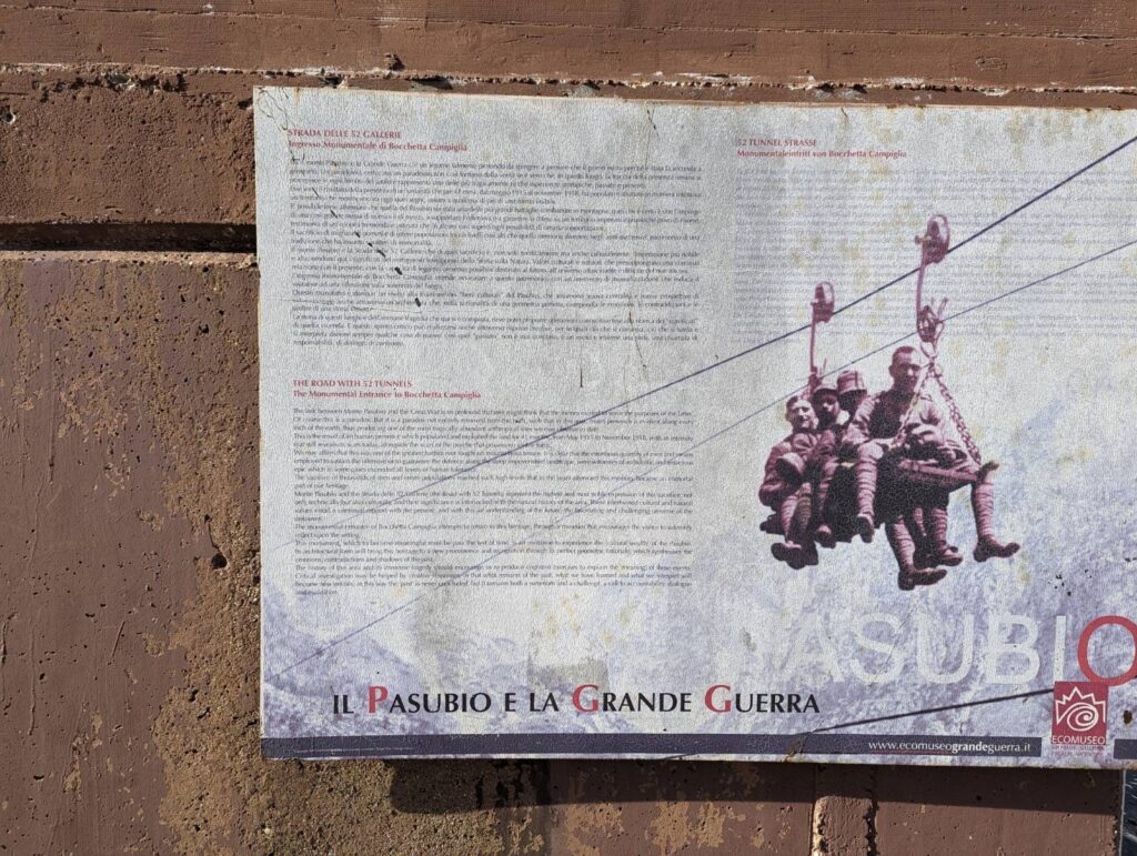
Built in 1917 by the 33rd Mining Company of the Italian Army, this secret military road was designed to transport troops and supplies safely away from Austrian artillery fire.
Conceived by Captain L. Motti and designed by Lieutenant Engineer Giuseppe Zappa, the project was an audacious feat of military ingenuity.
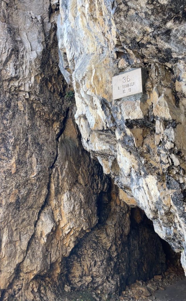
Soldiers and miners carved 6,555 meters (4 miles) of road into the rock, including 52 tunnels, all in just ten months—a testament to their resilience under extreme wartime conditions.
Imagine standing atop Mount Pasubio in the winter of 1917, as Lieutenant Zappa did, surveying the snow-covered terrain and envisioning a road hidden from enemy sight.
This winding path would snake from Forni Alti, through Fontana d’Oro Pass, and finally reach the Porte del Pasubio, ensuring the safe movement of troops and supplies.
Today, as you walk this historic trail, picture the mules carrying ammunition, the soldiers navigating the narrow ledges, and the unbreakable determination that shaped this remarkable road.
Why Hike the Strada delle 52 Gallerie?
- A Unique Historical Experience – Walk through tunnels hand-carved by soldiers in WWI.
- Incredible Mountain Views – Panoramic scenery of the Pasubio massif and the Venetian Prealps.
- An Unforgettable Adventure – Dark tunnels, towering cliffs, and dramatic landscapes keep every step exciting.
Parking & How to Get to Strada Delle 52 Galleries
PARKING FOR THE STRADA DELLE 52 GALLERIES
Parking at the Strada delle 52 Gallerie trailhead is available for just 6 euros for 24 hours. You’ll find parking meters located in both the lower and upper parking lots for your convenience.
The road leading to the Strada delle 52 Gallerie parking lot is narrow and two-way, so be sure to drive slowly and stay alert for oncoming traffic. Make sure you’re comfortable driving on tight, winding roads before heading up to the trailhead.
Best Route to the Strada delle 52 Gallerie Parking Lot
When navigating to the Strada delle 52 Gallerie parking lot, Google Maps may suggest a variety of routes. For the most scenic and direct route, I recommend driving from Vicenza to Schio, then heading up to Santa Caterina. Take Strada Pra Lungo, a narrow but beautiful road, passing the Monumento dei Caduti di Vallortigara (a World War I memorial), which marks an important historical spot on the way.
This route will lead you directly to Passo Xomo, where you’ll find the parking lot for the Strada delle 52 Gallerie hike.
How to Get to the Strada delle 52 Gallerie from Other Cities in Italy
If you’re planning a day hike from Vicenza to the Strada delle 52 Gallerie, here are the approximate travel times and distances from major cities in Italy:
- Venice to Strada delle 52 Gallerie: 1 hour 35 minutes / 125 km
- Verona to Strada delle 52 Gallerie: 1 hour 46 minutes / 104 km
- Milan to Strada delle 52 Gallerie: 3 hours 21 minutes / 252 km
- Innsbruck to Strada delle 52 Gallerie: 3 hours 19 minutes / 240 k
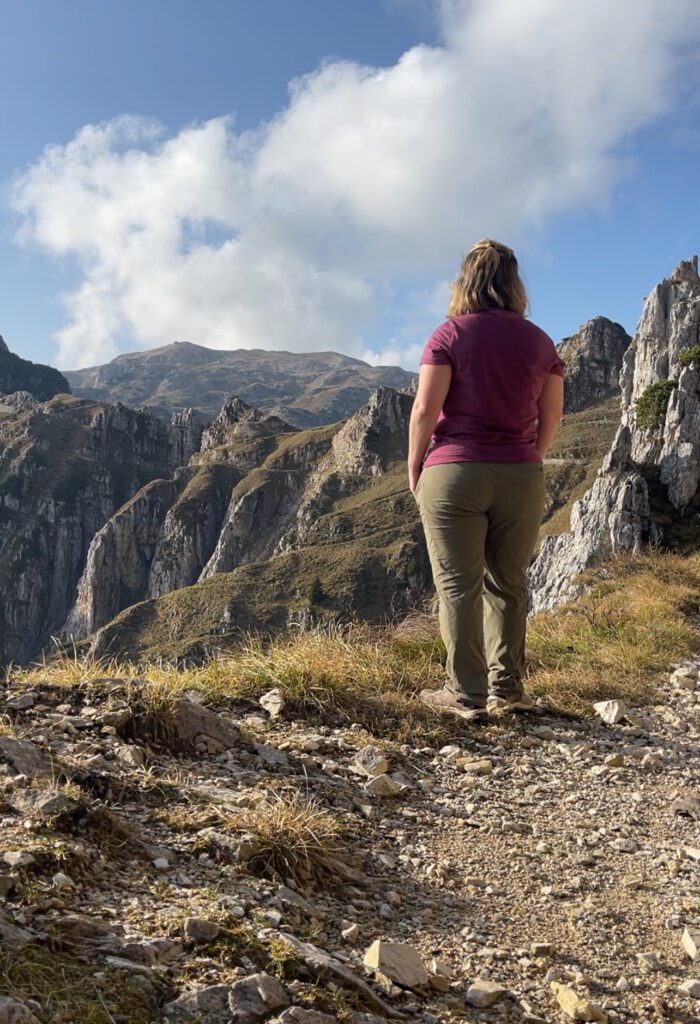
My Personal Experience on the Strada delle 52 Gallerie
Before you even step onto the trail, there’s a bit of practical housekeeping to take care of. Parking at the trailhead costs 6 euros and is coin-only, so come prepared.
Nearby, informational boards installed by the Veneto region explain the immense effort behind this route, detailing how the 33rd Mining Companies carved all 52 tunnels directly into the rock during World War I. It’s worth slowing down here; understanding what went into building this road changes how you experience every step of it.
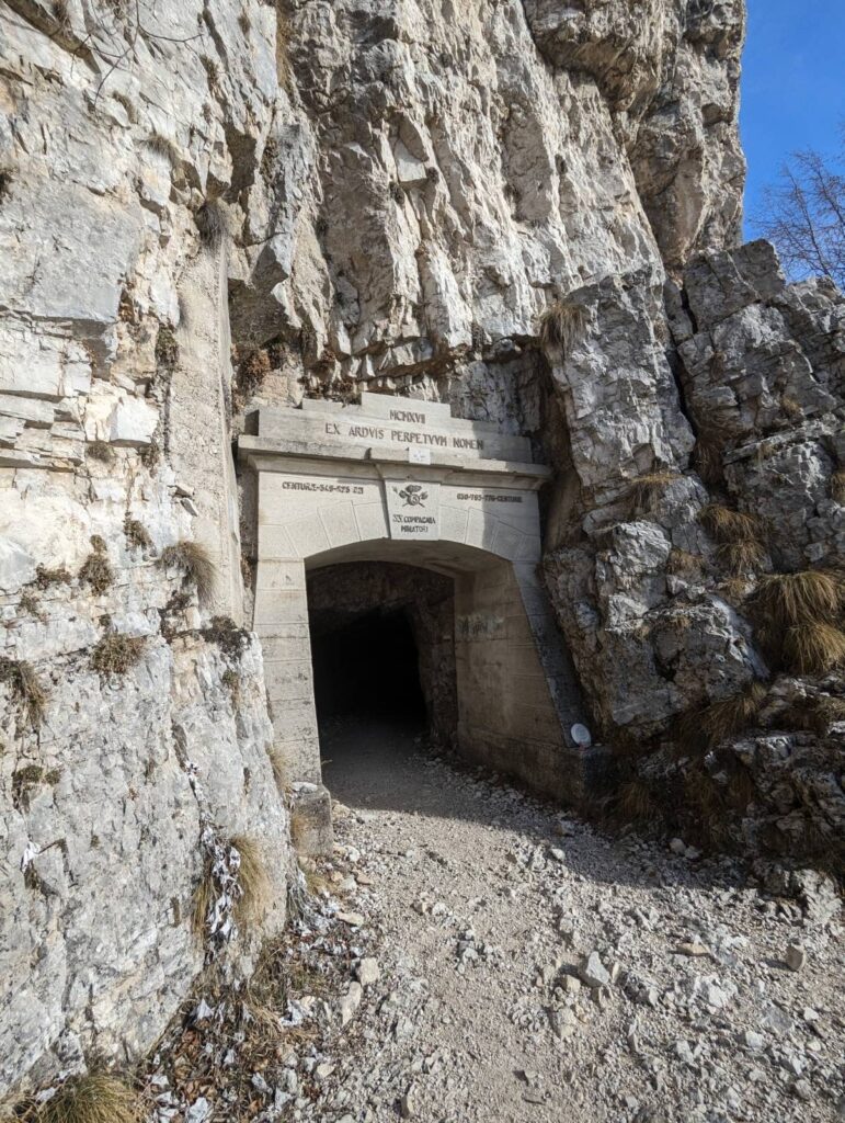
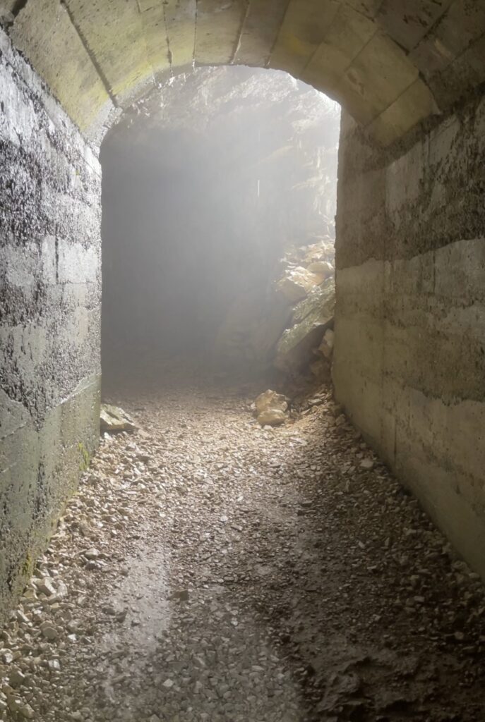
The First Tunnel
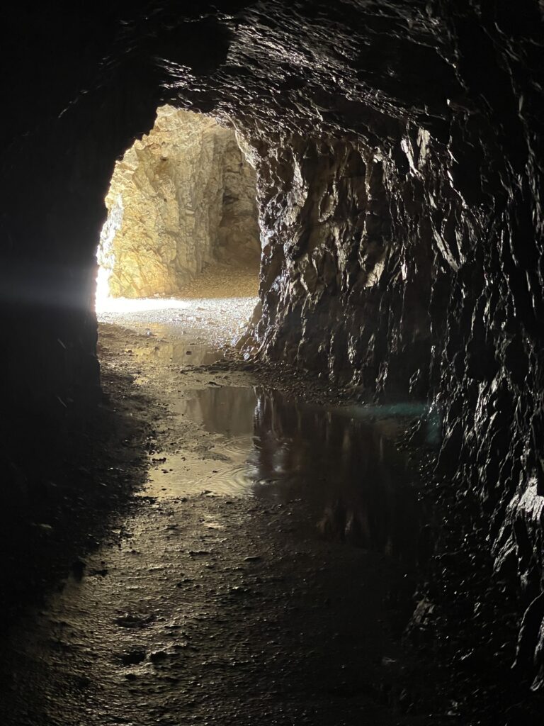
The first tunnel appears after a series of exposed bends, setting the tone immediately. You enter through a turnstile, and from that moment on, the trail feels like a transition — from ordinary mountain path to something far more historic and intense. As you continue upward, the views unfold relentlessly, with sheer drops and sweeping valleys appearing around every curve. Each tunnel bears a name tied to a person or place of historical significance, reinforcing the deep connection between this trail and Italy’s past.
Along the way, you’ll encounter memorials dedicated to the Alpini, some mounted directly into the tunnel walls and caves. These aren’t decorative stops; they’re reminders that this route is also an open-air memorial. I recommend pausing at a few of them, not just to catch your breath, but to acknowledge the human cost tied to this mountain.
The Ascent
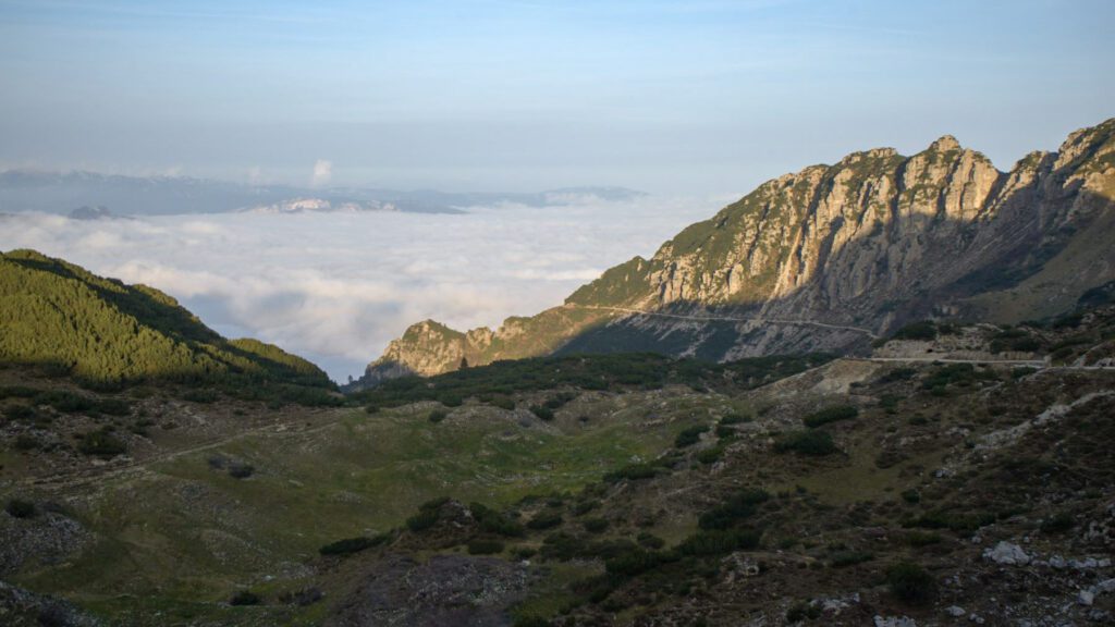
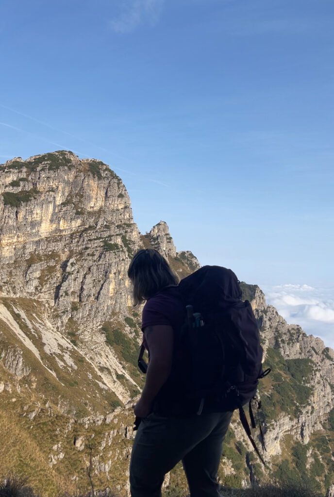
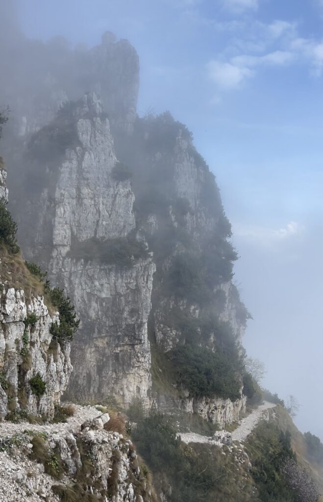
The ascent wastes no time asserting itself. The opening stretch is steep and exposed, weaving between pinnacles and cliffs as the trail climbs steadily. You’ll pass the Bella Laita spurs, and within the first 20 tunnels, you’ve already gained significant elevation, reaching roughly 1,700 meters. From there, the Val Camossara rises to about 1,842 meters, eventually easing into the almost-flat stretch near the Fontana d’Oro pass at 1,870 meters. That brief leveling feels earned — and temporary.
Summit and the Return
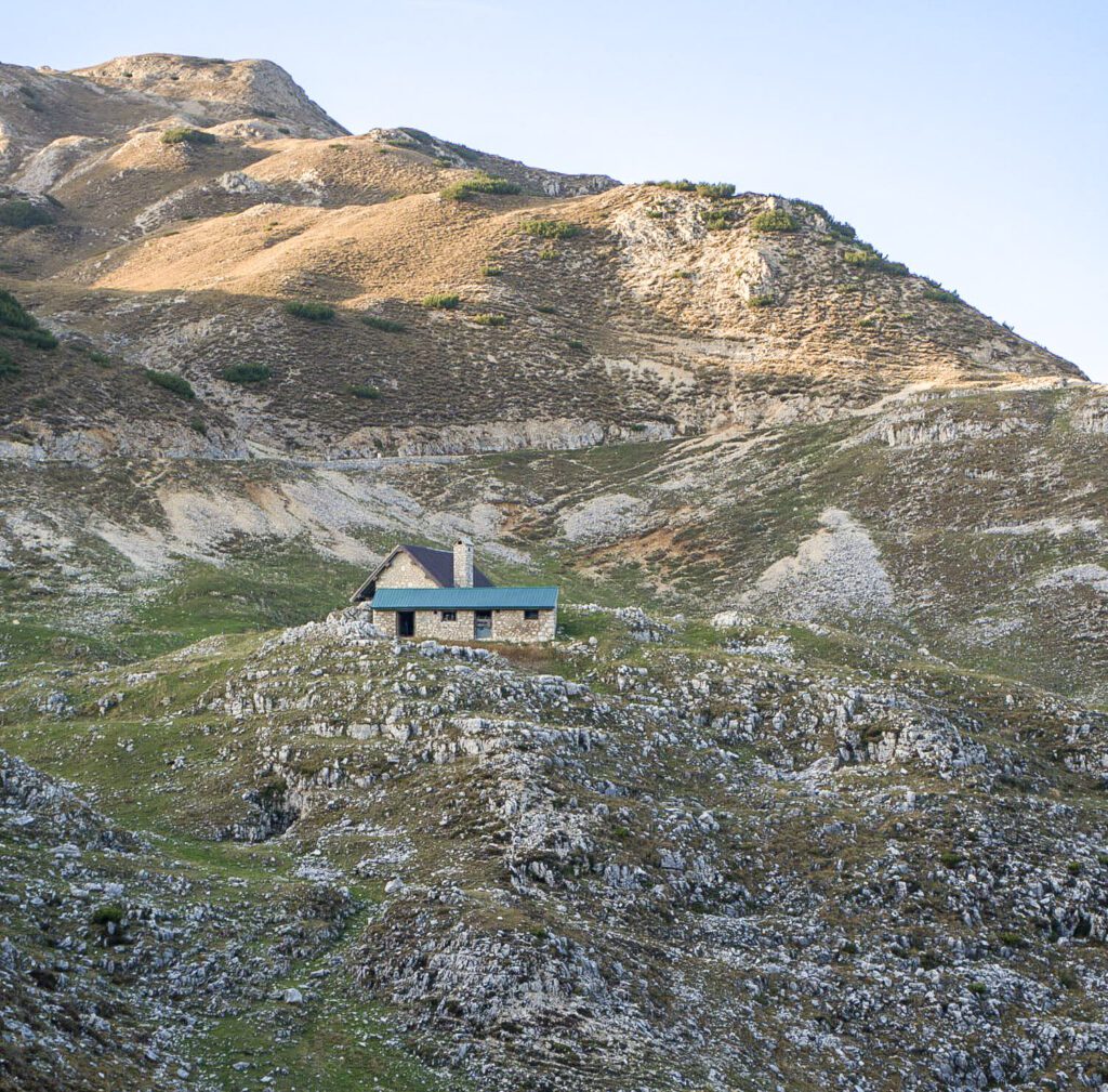
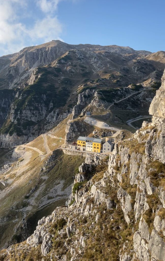
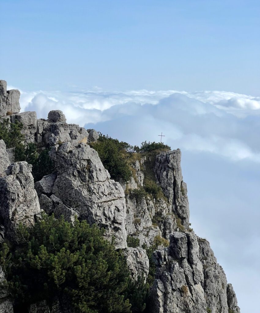
After the forty-eighth tunnel, you crest just over 2,000 meters above sea level, rewarded with one of the most dramatic vantage points on the route. From here, the trail begins to soften slightly as you follow it onward to Rifugio Achille Papa. If it’s open, this is where I strongly suggest stopping for a drink or a simple meal. It’s a chance to experience classic rifugio hospitality and take a real pause after a demanding climb.
For the descent, I recommend returning via the Scarubbi Road, which winds gradually back toward Bocchetta Campiglia. This route is easier to manage than the steeper shortcut paths, especially on tired legs. Hiking poles make a huge difference here — the descent can be punishing on your knees without them. From Bocchetta Campiglia, it’s about two kilometers back to the parking area. Take your time, hydrate, and don’t rush the final stretch.
If you choose to return through the tunnels instead, do so carefully. Fatigue sets in late on this hike, and the tunnels demand attention all the way to the end. This trail rewards patience and respect — right up until the very last step.
Which Season Should You Hike Strada Delle 52 Galleries?
Best Time to Hike the Strada delle 52 Gallerie
The weather conditions in the Strada delle 52 Gallerie area have been changing in recent years, so it’s always a good idea to check the forecast before heading out. Personally, I trust 3BMeteo for weather updates—Apple Weather has let me down more than once! Here’s a breakdown of the best seasons to hike the Strada delle 52 Gallerie:
Summer (July and August)
Summer is the prime hiking season for the Strada delle 52 Gallerie. The trail is snow-free, and the temperatures are generally pleasant, making for an enjoyable hike. The tunnels provide welcome shade, and the panoramic views of the Pre-Dolomiti are simply breathtaking.
Be sure to carry plenty of water and sun protection, as the Italian sun can be intense. Slather on that SPF—your skin will thank you later! Weekends tend to get crowded, so if you can, plan your hike during the week to enjoy a quieter experience.
Early Autumn (September)
September is another fantastic month for hiking. With cooler temperatures, hiking becomes much more comfortable. As you gain altitude, the foliage starts changing to warm, autumn hues, creating a stunning landscape. It’s a perfect time to experience the beauty of the Strada delle 52 Gallerie in a more peaceful setting.
However, temperatures can vary, so be sure to bring layers to stay comfortable during the cooler mornings and evenings.
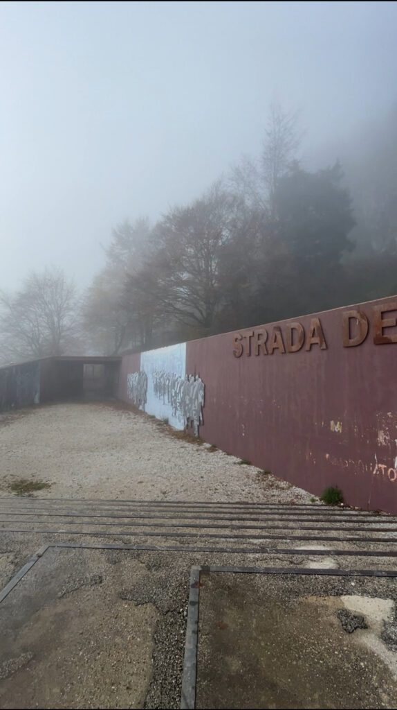
Late Autumn (October)
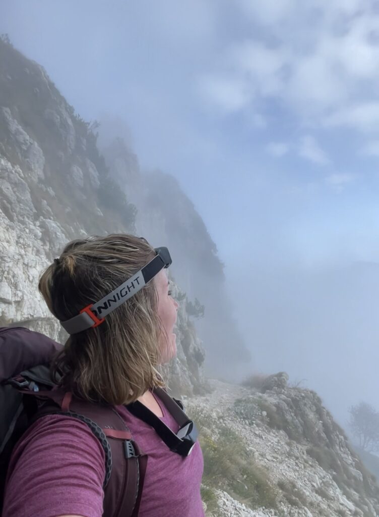
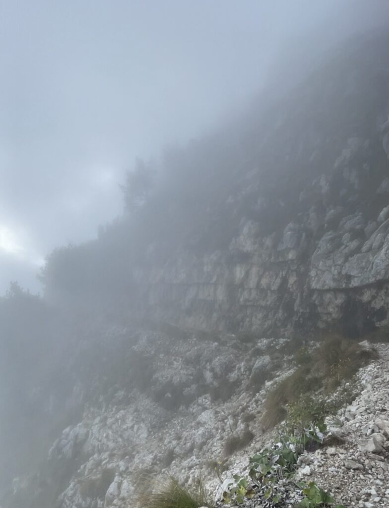
October is a magical time to hike the Strada delle 52 Gallerie. The crisp mornings and misty tunnels create a mysterious and enchanting atmosphere that makes the hike feel like something out of a fairytale. The fog adds an unforgettable touch to the experience.
Make sure to dress in layers and check trail conditions, as some sections can be slippery in the late autumn months. With the time change, days get shorter, so plan to leave early to ensure you have enough daylight to reach the rifugio and return to your car safely.
I remember hiking back in the dark on Scarubbi Road—it wasn’t terrifying, but it was definitely inconvenient. Avoid this by planning accordingly.
Winter (Avoid Completely)
Winter hiking on the Strada delle 52 Gallerie is not recommended. As temperatures drop, ice and snow can make the trail extremely treacherous. The trail is officially closed during winter months, so it’s best to avoid visiting during this time. Be sure to check for safety guidelines and plan your trip during the open seasons for a safe and enjoyable experience.
Where to Stay Near Strada Delle 52 Galleries
If you’re planning to hike the Strada delle 52 Gallerie, finding convenient accommodation nearby will make your trip even easier. Whether you’re looking for a cozy mountain refuge, a charming hotel, or a guesthouse, there are plenty of options to choose from near the trailhead.
As a partner with Stay 22, I’ve included an interactive map of nearby hotels to help you find the perfect place to stay during your visit. You can explore a variety of accommodations, from budget-friendly to more luxurious options, all just a short drive from the Strada delle 52 Gallerie.
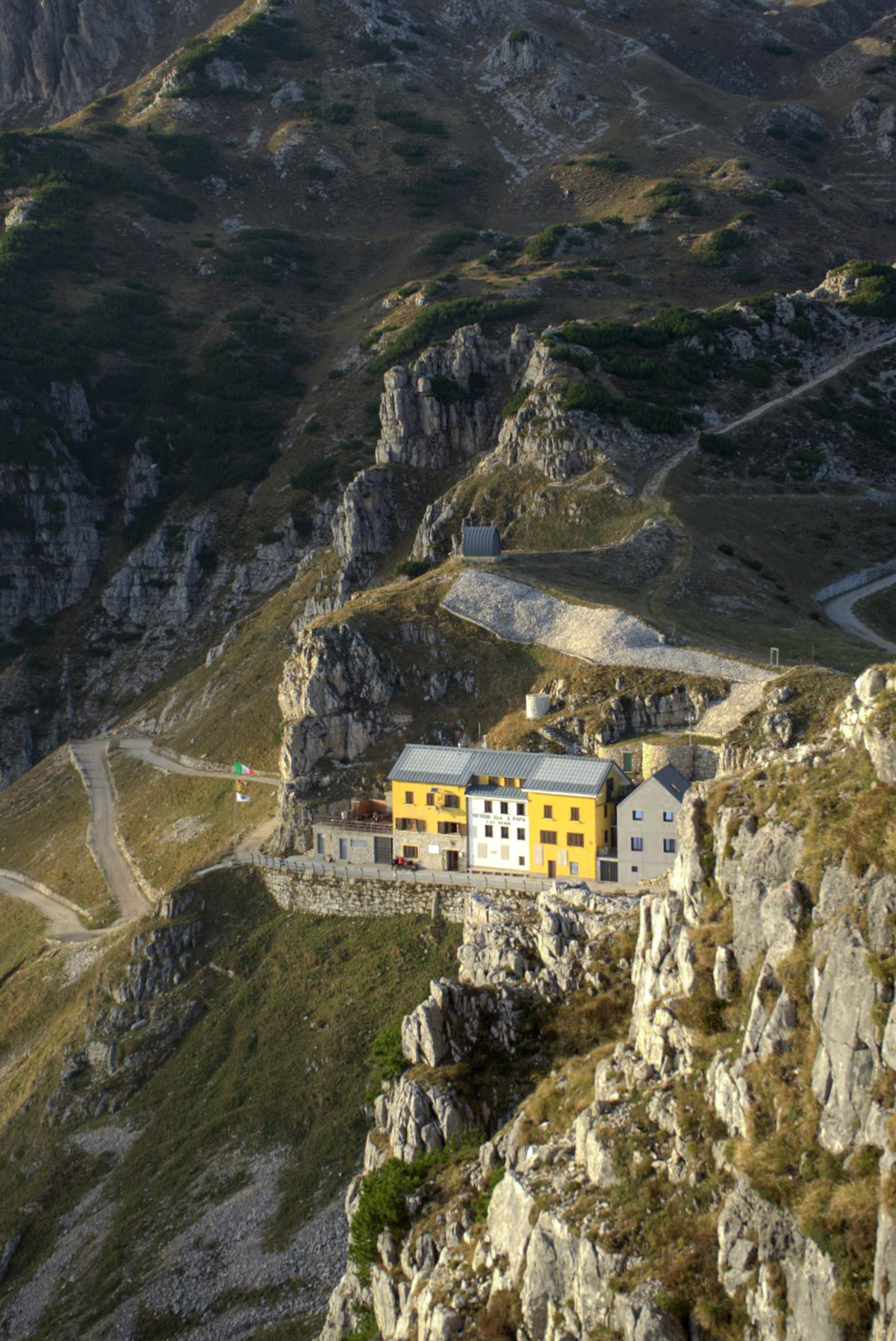
If you’re looking to extend your adventure on the Strada delle 52 Gallerie, why not consider staying at a rifugio? Nestled at 1928 meters above sea level, Rifugio Achille Papa offers a unique opportunity to experience the trail from a whole new perspective.
Named after Major General Achille Papa, a key figure in World War I, this refuge is steeped in history. Located at Porte del Pasubio on the Pasubio Massif, Rifugio Achille Papa was originally a masonry shelter that was later converted into a military barracks during the war. It’s a fascinating spot for history enthusiasts and hikers alike.
Rifugio Achille Papa is open every day from June 1st to October 13th, 2024, and then on weekends only from October 14th to November 10th, 2024. It’s a perfect place to rest and take in the breathtaking views of the surrounding mountains.
For more details, including availability and reservations, visit Rifugio Achille Papa’s website.
Brace yourself—the initial ascent is steep, a dance between pinnacles and cliffs. You’ll pass the ‘Bella Laita’ spurs, and within just 20 tunnels, you’ll ascend to 1,700 meters. The ‘Val Camossara’ rises to 1,842 meters, and there, against the sky, you’ll find an almost flat stretch—the Fontana d’Oro pass at 1,870 meters.
A few Gentle Reminders:
- For the return journey, take the Scarubbi road—a winding descent that leads you back to Bocchetta Campiglia. Use your hiking poles because the descent down is terrible on the knees if you choose to take the shortcuts down the mountainside
- It’s about 2km back to the parking lot from here and be patient with yourself.
- If you choose to take the tunnels back to the parking lot please be safe.
What to Bring With You
- HEADLAMP: Yes, I’m shouting it at you! You’ll need a headlamp for certain sections of the trail, especially in the tunnels. It’s an essential part of your gear.
- Water: Stay hydrated, but let’s be sustainable! Bring a reusable water bottle to reduce waste and keep your eco-footprint small while hiking.
- Rain Jacket: The weather in the Dolomites can change unexpectedly, so a rain jacket is a must. Be prepared for sudden rain showers or gusty winds.
- Sturdy Hiking Boots: This isn’t a tennis shoe hike! You’ll encounter slippery rocks and wet tunnels, so make sure to wear sturdy, waterproof hiking boots to stay safe and comfortable.
- Snacks: Let’s be real—I get hungry on hikes, and you will too! Pack high-energy snacks like trail mix, granola bars, or fruit to keep you fueled on your journey.
- Leave No Trace: A crucial reminder: Leave No Trace! This means don’t litter and be respectful of the environment. Take your trash with you and help preserve the beauty of the Strada delle 52 Gallerie for future hikers!
Pictures of the Strada Delle 52 Galleries


Best Hiking Applications to Find This Trail?
Komoot works pretty well in Europe with new routes popping up every day. This is the application I used to hike the 52 Tunnels.
Curious about my other blog posts that are related to Italy and the Dolomites?⬇️
- Five of the Best Hikes in the Italian Dolomites near Cortina Di Ampezzo
- What to Expect while staying at Rifugios in the Dolomites
- Driving in Italy: 5+ Important tips You Should Know
- The Best Things to do in Vicenza, Italy:
- Sentiero Dei Grandi Alberi:”Trail of big trees” Hike Near Vicenza, Italy
- What are Vignettes and Which Countries in Europe Require Them?
Conclusion
I hope this guide helps you plan your day at the Strada delle 52 Gallerie! Whether you’re a first-time hiker or a seasoned pro, this incredible trail offers a mix of history, breathtaking views, and a true outdoor adventure.
If you have any questions about the hike or need recommendations, feel free to leave a comment below! I’d love to hear about your experience and offer any additional tips to make your hike even better.
Statement of Liability
I do not undertake and do not have any responsibility for the accuracy of any information provided or to determine or assure the suitability or safety of any hike, driver, vehicle, or other event or any related activity, in general, or as to a particular person. Each person who participates accepts responsibility for making their determinations and for their safety, conduct, and well-being; recognizes that possible hazards attend outdoor activities, and agrees to participate solely at their own risk