Five of the Best Hikes in the Italian Dolomites You Can Do Near Cortina d’Ampezzo
Living in the Veneto region of Italy has its undeniable advantages. Not only am I just a stone’s throw from the historical wonder of Venice, but I’m also perfectly positioned to explore the breathtaking Dolomites. This unique location offers me easy access to some of the most awe-inspiring hikes near Cortina D’Ampezzo and luxurious stays in the Dolomites.
While it can be tough to escape the crowds during the busy summer months and the vibrant fall when the Dolomites are painted in stunning autumn colors, there are still hidden gems to be found. The Dolomites have many lesser-known hikes that offer an escape from the usual tourist crowds.
In this guide, I’ll take you through some of these tranquil, off-the-beaten-path trails, where you can experience nature in its purest, most intimate form. These hikes are perfect for those seeking serenity in one of the most beautiful mountain ranges in the world.
Read my other Blogs about the Dolomites⬇️
Before we embark on this adventure together, don’t miss out on any updates, sign up for my newsletter!
Lago Di Sorapis From Passo Tre Croci
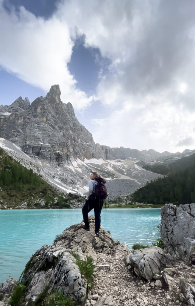
Tucked away in the heart of the Dolomites, and merely a stone’s throw from Cortina d’Ampezzo, you’ll find the enchanting Lago Di Sorapis. This hike was not just another trek for me, but one of my favorites that I had been eagerly anticipating.

Check out my blog post on Hiking Lago di Sorapis from Tre Croci here for more details on my experience!
If you’re planning on catching the sunset on this hike, remember to bring a headlamp! It’s quite easy to lose track of time and get swept away in the mesmerizing beauty of the sunset, which could result in navigating your way down in the dark! Please only attempt a sunset hike to Lago to Sorapis in good weather, as I’d only recommend in good weather.
Trail Details & Terrain
- Journey Length: 12 km (8 miles) if you’re planning a straightforward there-and-back hike. Opting for the loop hike will add more time to the journey.
- Altitude:
- Starting Elevation: ~1,800 meters (5,900 feet)
- Lake Elevation: 1,920 meters (6,300 feet)
- Highest Elevation (Loop Trail): 2,310 meters (7,575 feet) at Forcella Marcuoira
- Time Commitment:
- Out-and-Back Route: 3 to 5 hours
- Loop Trail: 5 to 7 hours
- Difficulty Level: Moderate to challenging. Expect some scrambling, narrow ledges, and cables at certain points.
- Trail Features:
- Awe-inspiring views of the turquoise lake
- Expansive landscapes and jagged peaks of the Dolomites
- Steep ascents and narrow paths requiring sure-footedness
- Certain sections are highly technical and may require alpine experience
Rifugio Monte Piana – A. Bosi – Monte Piana Loop from Verocai: A Journey Through History and Nature
If you’re looking for a memorable hike in the Dolomites that offers both spectacular views and historical depth, the Rifugio Monte Piana – A. Bosi – Monte Piana Loop is a must-do. This intermediate-level hike covers a distance of 8.41 miles (13.5 km), with an elevation gain and loss of 2,200 feet (670 meters). It’s perfect for those with good physical fitness, though it requires a bit of sure-footedness due to some steeper sections. The path is mostly accessible with a mix of well-marked hiking trails and alpine paths. The hike also offers the opportunity to reflect on World War I history, as you’ll pass by old military trenches, memorials, and scenic spots that speak to the area’s somber past.
Starting Point: Verocai
Your adventure begins from the Verocai area, a convenient access point to the trailhead. You can reach the start of the hike by bus or jeep shuttle from Misurina, which makes it easy for travelers using public transport. Misurina itself is a picturesque mountain village that offers incredible views of surrounding peaks, setting the stage for the awe-inspiring trek ahead.
Rifugio Monte Piana – A. Bosi: Your First Stop
After a steady ascent, you’ll reach Rifugio Monte Piana – A. Bosi, a popular mountain hut where hikers often pause to refuel and take in the views. From here, you can soak in the dramatic landscape, with sweeping vistas of the Dolomites and the Tre Cime di Lavaredo in the distance. The hut also serves as a gateway to the various historical landmarks of the hike, including war memorials and the nearby trenches.
Monte Piana and the Trench Walk
One of the most striking features of this hike is the presence of the military trenches on Monte Piana, which are remnants of the battles fought during World War I. As you walk through these historical sites, the landscape will take on a different meaning, with the beauty of nature contrasting with the somber history of the area. You’ll pass by memorials and plaques, offering a glimpse into the past and the heavy toll of war. The Monte Piana summit provides panoramic views of the surrounding peaks, making it a peaceful yet reflective spot to enjoy the scenery.
Trail Details and Terrain
- Distance: 8.41 miles (13.5 km)
- Elevation Gain/Loss: 2,200 feet (670 meters)
- Difficulty: Intermediate; requires good fitness and sure-footedness
- Terrain: A mix of gravel paths, alpine trails, and well-maintained hiking paths
- Highest Point: 7,550 feet (2,300 meters)
- Lowest Point: 5,775 feet (1,760 meters)
The trail is mostly accessible, but there are sections of steep, rocky paths, particularly on the way up to Monte Piana, so be prepared for some tricky footing. Some parts of the trail are gravel and dirt, while others are paved. The higher altitudes can also make the air thinner, so be sure to pace yourself.
A Must-Do for History Buffs and Nature Lovers
The Rifugio Monte Piana – A. Bosi – Monte Piana Loop is an incredible blend of history and nature. Whether you’re hiking for the breathtaking views, the history, or the sense of peace that comes with walking through such a scenic and solemn landscape, this hike has it all. From the summit, you’ll be treated to unparalleled vistas of the Dolomites and Tre Cime di Lavaredo, making it a hike you won’t forget.

Insider Tips:
- Best Time to Hike: Late spring to early fall, when the weather is ideal for hiking and the paths are clear of snow.
- Proximity to Misurina: Easily accessible by public transport or jeep shuttle from the village of Misurina.
- Public Transport Access: The trailhead can be reached via bus or shuttle from Misurina, making it convenient for visitors using public transport.
So, if you’re ready for a hike that offers stunning views, a bit of history, and a healthy physical challenge, the Rifugio Monte Piana – A. Bosi – Monte Piana Loop is a perfect adventure in the Dolomites.
Lake Ghedina – Ponte sul Fiume Boite Loop from Cortina d’Ampezzo

If you’re seeking a challenging yet rewarding hike in the Dolomites, the Lake Ghedina – Ponte sul Fiume Boite loop offers a unique opportunity to immerse yourself in the stunning alpine scenery of Cortina d’Ampezzo. This hike covers a distance of 11.0 miles (17.7 km), with an elevation gain and loss of 2,500 feet (762 meters).
It’s classified as an expert hike, requiring good physical fitness and sure-footedness, particularly on certain rocky sections. Accessible paths make it suitable for those prepared for a moderate to difficult trek, but it’s essential to be cautious on the rougher terrain. The hike is also accessible via public transport from Cortina d’Ampezzo.

Starting Point: Cortina d’Ampezzo
The adventure begins from the charming town of Cortina d’Ampezzo, easily reachable by bus from the town’s main transport hubs, Known for its picturesque mountain setting, Cortina is a well-known resort town, offering both winter and summer activities. From the town center, you will head towards the tranquil Lake Ghedina.
Lake Ghedina: A Green Oasis
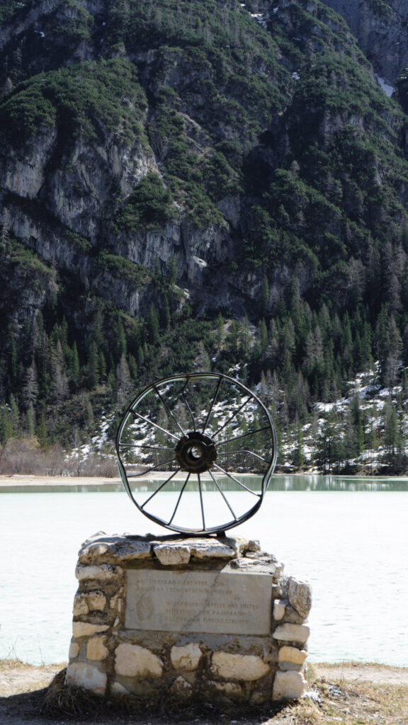
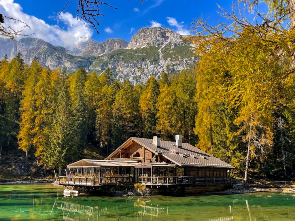
Lake Ghedina is the highlight of this hike, offering a peaceful retreat just a few miles from Cortina. Surrounded by lush greenery, the lake’s emerald waters are especially captivating, with their colors changing throughout the day depending on the sunlight. During summer, it is the perfect place to relax, enjoy a peaceful picnic, or simply absorb the serenity of the surroundings. In winter, the lake transforms into a snow-covered wonderland, attracting visitors from the nearby ski resorts.

The Path to Crepe de Cianderou
From Lake Ghedina, the trail continues towards Crepe de Cianderou, a prominent rocky outcrop that offers spectacular views. Located along path 409, this point is easily accessible from both Lake Ghedina and Col Drusciè. Here, you’ll be treated to panoramic vistas of the Ampezzo basin, with iconic peaks such as Sorapiss, Croda da Lago – Cernera, Nuvolau, and the Tofane groups.
Scenic Trails and Views of Mount Cristallo
As you continue along the trail, you’ll pass through scenic stretches offering breathtaking views of Mount Cristallo, Croda Rossa, and Pomagagnon. Each corner of the path reveals a new and jaw-dropping perspective of the Ampezzo Valley. These sections of the hike are well-loved by hikers, and it’s no surprise that 30 hikers recommend the scenic route for its unparalleled beauty.
Col Rosà and Croda Rossa
One of the key vantage points along the route is Col Rosà, where you’ll encounter an expansive view of Croda Rossa and the surrounding peaks. The terrain here is diverse, and the dramatic mountain scenery never fails to impress.
Ponte sul Fiume Boite: The River Crossing
The last major highlight of the hike is the Ponte sul Fiume Boite. This bridge spans the Boite River in the locality of Fiames and offers a tranquil and scenic place to rest. It’s a popular destination for hikers, and the river adds an element of serenity to the landscape, making it an ideal spot to pause and reflect before completing the loop back to Cortina d’Ampezzo.
Trail Details and Terrain
- Distance: 11.0 miles (17.7 km)
- Elevation Gain: 2,500 feet (762 meters)
- Difficulty: Expert; requires good fitness and sure-footedness
- Terrain: A mix of gravel, unpaved, and paved paths, with sections of alpine and natural trails
- Highest Point: 5,825 feet (1,774 meters)
- Lowest Point: 3,950 feet (1,204 meters)
The trail includes a variety of surfaces: from mountain hiking paths and gravel trails to asphalt roads and paved streets. The sections with unpaved paths and gravel require some attention, particularly if you’re hiking during the early or late seasons, when trails may be muddy.
Lago Federa – Ambrizzola Fork loop from Salieto
Lago Federa – Ambrizzola Fork Loop Hike
Tucked in the heart of the Dolomites, the Lago Federa – Ambrizzola Fork loop offers an enchanting mix of alpine lakes, panoramic mountain views, and a glimpse into the geological wonders of this UNESCO World Heritage Site. Starting from Salieto, this hike is a rewarding challenge, perfect for those who want to immerse themselves in the natural beauty of the Dolomites.
Journey Length
- Distance: 13 km (8.07 miles) loop
- Elevation Gain: 840 meters (2,750 feet)
- Highest Point: 2,455 meters (8,050 feet)
- Lowest Point: 1,690 meters (5,550 feet)
Time Commitment
- Estimated Duration: 5 to 7 hours, depending on pace and stops along the way.
Difficulty Level
- Expert: A high level of fitness is required, along with sure-footedness. While the paths are mostly accessible, there are steep ascents and rugged terrain.
Trail Highlights
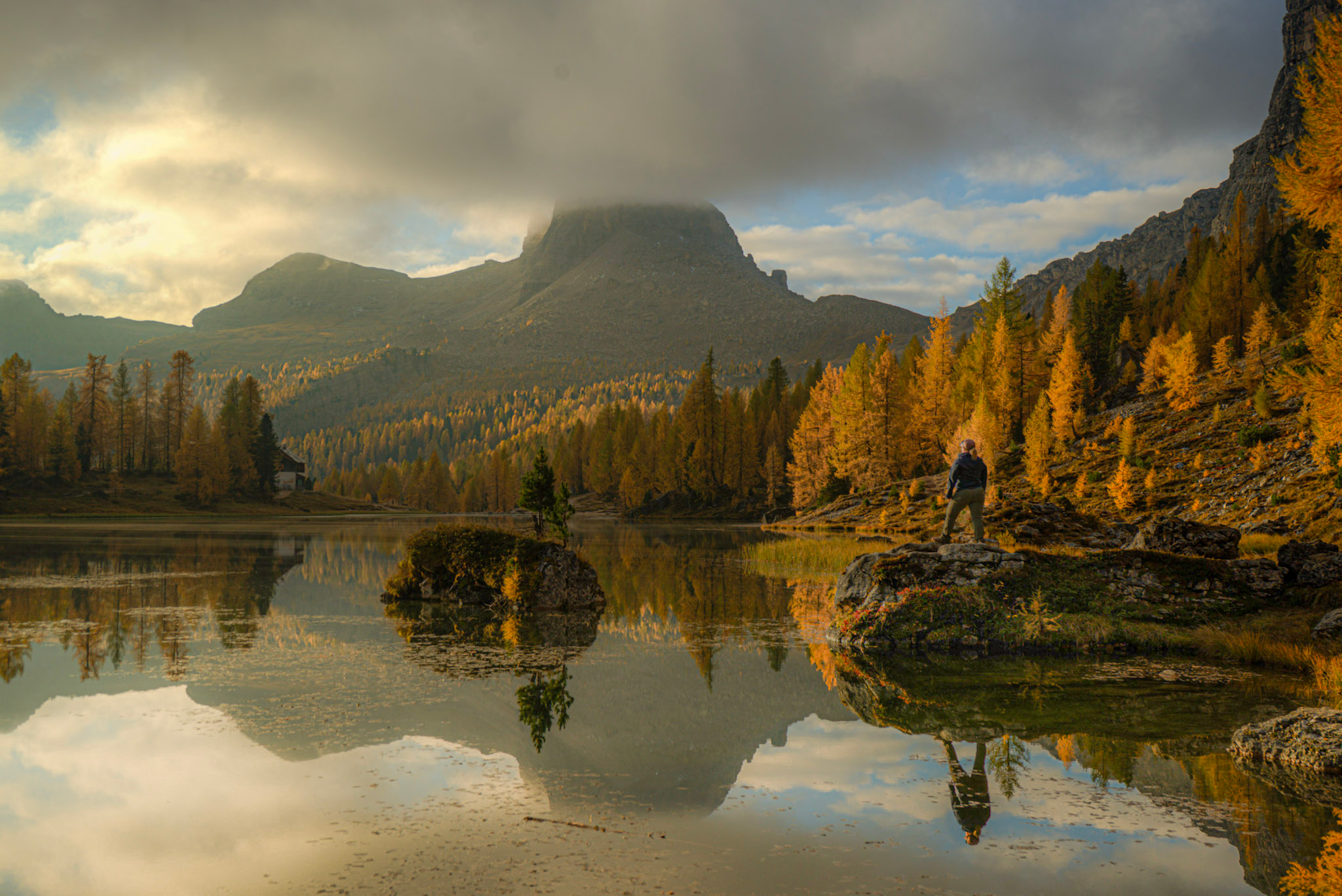
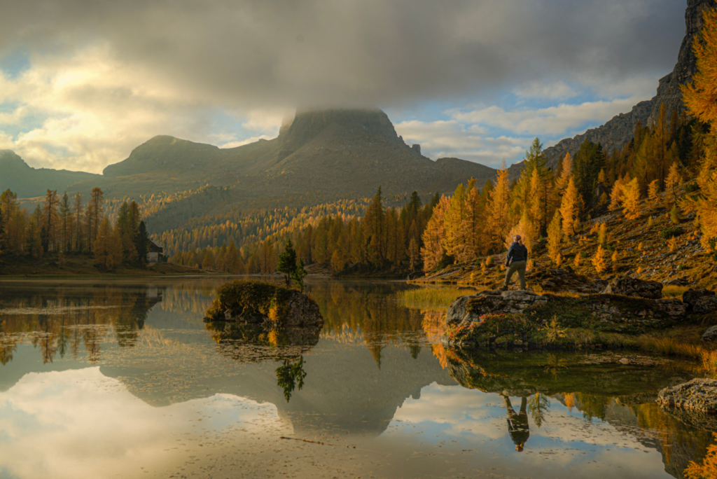
- Lago Federa (Lake Federa): Nestled beneath the Croda da Lago, this stunning alpine lake is a must-see. The reflections of the jagged peaks on the shimmering water make for incredible photos. This spot is also a great place to rest and recharge.
- Rifugio Croda da Lago: A historic refuge, originally built in 1901, now a welcoming stop for hikers looking to enjoy a meal with breathtaking mountain views.
- Ambrizzola Fork (Forcella Ambrizzola): Sitting at 2,277 meters (7,470 feet), this saddle offers a spectacular viewpoint of Monte Pelmo and the surrounding Dolomites. It also serves as a key junction for various hiking trails in the region.
- Mirador de la Forcella de Formin: A high-altitude viewpoint at over 2,500 meters (8,200 feet) that provides a panoramic look at the Formin Valley, Tofane massif, Mount Antelao, and Mount Pelmo.
- Riesige Felsblöcke (Giant Boulder Field): This section features massive rock formations that have tumbled from the cliffs above, creating a dramatic landscape.
Trail Features
- Terrain: A mix of alpine paths, rocky sections, and some technical areas requiring sure footing.
- Trail Conditions: Mostly natural terrain with some unpaved sections.
- Public Transport Access: The starting point at Pian del Pantan (Rù Corto) is accessible via bus, making it a convenient hike for those without a car.
Tips for Hikers
- Start early to allow enough time for breaks and to take in the stunning scenery.
- Bring plenty of water and snacks, especially if planning a longer stop at the refuge.
- Wear sturdy hiking boots with good grip for navigating rocky and uneven sections.
- If attempting this hike in late autumn or early spring, check weather conditions as snow can linger at higher elevations.
- Consider bringing trekking poles for added stability on steeper sections.
This hike is a perfect choice for those looking for an unforgettable Dolomites adventure, combining alpine beauty with a touch of history and challenge. Whether you’re tackling the loop for the views or the physical challenge, it’s sure to be a memorable experience!
Nuvolau Refuge – Cinque Torri Loop from Salieto: A Spectacular Hike in the Dolomites
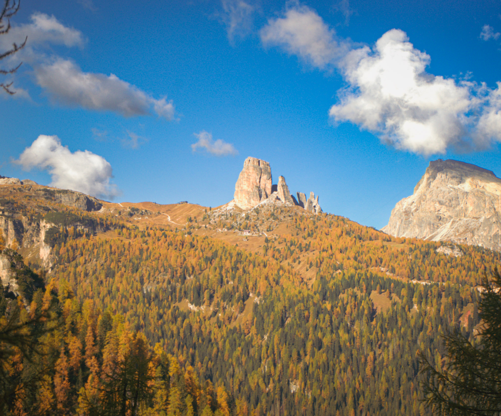
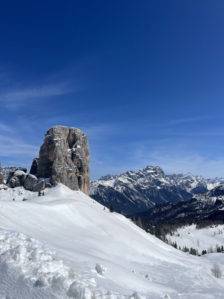
In April of 2024, I embarked on a modified version of this hike, trading traditional hiking boots for snowshoes. The experience was nothing short of fantastic. Guided by an expert who knew the terrain like the back of his hand, I navigated the trail with ease and excitement. The views that greeted me were phenomenal – a breathtaking panorama of the Italian Dolomites. Even in snowshoes, I can confidently say that this ranks among the best hikes in the Italian dolomites that I’ve ever undertaken. It was a fusion of physical challenge and natural beauty!
- Journey: Your adventure begins at the Seggiovia Cinque Torri ski lift’s parking lot. From the parking area, glance to the left of the ski lift. You’ll spot a trail that meanders towards Lago Bai di Dones. As you tread along, keep an eye out for the trail markers. They’re your reliable guides leading you to Rifugio Scoiattoli. After a scenic hike, you’ll find yourself at Rifugio Scoiattoli. This is a perfect spot to catch your breath, hydrate and grab lunch! You’ll continue on to Rifugio Averau. The trail might challenge you a bit more here, but the panoramic views are a rewarding treat. The last leg of your hike takes you from Rifugio Averau to Rifugio Novalau. As you tread this stretch, the Dolomites’ breathtaking beauty will accompany
- Altitude: The hike commences at Cinque Torri, situated at an altitude of 2361 meters. The trail then ascends to the highest point at Rifugio Novalau, which stands at an altitude of 2575 meters. You’ll start at the ski lift and parking is accessible.
- Time Commitment: Allocate around 5 to 6 hours for this hike. This timeframe allows for a leisurely pace and ample opportunities to appreciate the scenery and take breaks.
- Difficulty Level: This trail is rated as moderate to strenuous. While it’s not overly challenging, it does require a fair level of fitness and some prior hiking experience.
- you.
What Should You Pack for the Best Hikes Near Cortina Di Ampezzo??
First and foremost, I always emphasize the importance of preparedness to others. This isn’t just advice; it’s a lesson learned from personal experience. In fact, I once suffered a heat-related incident during a hike because I hadn’t packed enough water and wasn’t wearing the right gear. It was a wake-up call for me. Consequently, I always caution fellow hikers to pack wisely and bring the right gear.
Therefore, if you’re planning a weekend of hiking in the Italian Dolomites, here’s a Dolomiti packing list to help you prepare:
Clothing
- Hiking boots: A good pair of waterproof hiking boots is essential.
- Hiking socks: Opt for moisture-wicking and quick-drying materials.
- Layered clothing: The weather can change quickly in the mountains, so pack lightweight, moisture-wicking base layers, insulating mid-layers, and a waterproof outer layer.
- Hat and gloves: Even in summer, it can get chilly at higher altitudes.
- Sunglasses and sun hat: Protect yourself from the sun’s rays.
Gear
- Backpack: A comfortable backpack with good support is crucial. I love my Osprey Kyte 38 Liter backpack. There is so much room for everything I need and it’s sturdy! (not an affiliate link)
- Trekking poles: These can be helpful on steep or rocky terrain. I bring mine along any chance I get!
- Water bottle or hydration bladder: Staying hydrated is key! I bring my hydroflask and I have a life straw just in case I need to use it!
- Map and compass: Even if you plan to use a GPS, it’s always a good idea to have a backup. I personally just started to use Komoot! It’s a great app here in Europe and all trails are easily identifiable
- Headlamp or flashlight: In case you get caught out after dark. This comes in handy for those of you who like to chase the sunsets with your cameras!
Other Essentials
- First-aid kit: Include band-aids, antiseptic wipes, tweezers, and any necessary personal medication.
- Snacks: High-energy snacks like trail mix or energy bars can be a lifesaver.
- Sunscreen and lip balm: Protect your skin and lips from the sun.
- Camera: To capture the stunning views!
- Euro: This is for the huts
Thanks for reading this all the way through!
Learn all about the Strada Delle 52 Galleries near Vicenza
Your Guide to Hiking the Strada Delle 52 Galleries
Want to Travel By Train in Italy?
Italy by Train: How to Travel by Train in Italy For First Timers